
Establish forest where there was none
Afforestation on land that has not been forest since 31 December 1989, subject to the other requirements.
METHODOLOGY / EXPLAINER
A visual tour of the framework of the European Union and its application to an olive grove in Spain. You can then test your own hectares with a hypothesis of additional carbon per hectare.
CHOOSE THE PATH · OCTOBER 2026
Select the route you want to explore. For an existing olive grove, we are studying the European carbon farming framework; the Spanish state register currently publishes requirements for forestry projects.
The EU’s voluntary CRCF framework includes a methodology for farming and agroforestry on mineral soils. For an olive grove, the parcel, practices and certification programme must meet its requirements. Approval of a methodology does not automatically certify a farm.
Status checked on 6 October 2026: the Commission’s public list of schemes ↗ shows applications for recognition under review. Before starting a project, check which scheme is recognised for this activity.
Location, soil, previous land management and the proposed change. The certification scheme must apply the relevant European methodology.
Establish with evidence what would happen without the project and prepare the required monitoring plan.
Compare soil carbon and emissions with the baseline, including associated emissions, uncertainty and the required adjustments.
An independent entity audits the result. Only a recognized program will be able to certify and register units according to the European framework.
Sources: European Commission CRCF framework ↗ · European methodologies ↗
The current instructions of the MITECO absorption registry admit these forestry actions:
Afforestation on land that has not been forest since 31 December 1989, subject to the other requirements.
Measures to restore forest cover in areas affected by forest fires.
MITECO requires a management plan, a calculation using its official tool and monitoring. Eligibility is assessed case by case.
To explore soil carbon in an olive grove, select “European Union · Carbon farming”. The 50 ha example on this page belongs to that illustrative explanation.
WHERE THE DATA COME FROM
Studying a real farm involves combining different kinds of evidence according to the applicable methodology. A photo alone cannot calculate credits.
They document practices, dates and the visible condition of a parcel. They support field records but do not measure soil carbon.
They help track changes in cover and vegetation over time. They need interpretation and contrast with what is happening on the ground.
Soil samples and other field data provide direct measurements for the calculation required by the applicable method.
On this website: the main image and the olive grove diagram are conceptual; we do not yet show photos or satellite images of our own parcels. Source: European Commission, frequently asked questions about the CRCF framework ↗
ILLUSTRATIVE EXAMPLE / NOT A CRCF CALCULATION
The area alone does not generate credits. First, previous land management must be documented, a specific change introduced and the portion of the result attributable to that change measured.
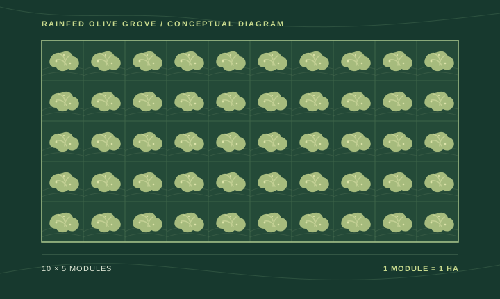
Document the previous management and define the baseline with the period and tests required by the applicable methodology: what would have happened without the project.
For example, a planned cover crop. Its management, inputs and soil data are recorded throughout the monitoring period.
The measured change is compared to the baseline. Associated emissions, uncertainty and other adjustments to the methodology are then accounted for.
ARITHMETIC SIMULATION · 5 YEARS
Suppose soil carbon changes by the following amounts per hectare. These figures are invented to explain the calculation.
+0.6 t C/ha hypothetical difference from the baseline.
CONVERSION TO CO₂
0.6 t C/ha × 50 has × 44/12
110 t CO₂The 44/12 factor converts carbon into CO₂. This gross result illustrative corresponds to five years. Additional emissions, uncertainty and other adjustments would still need to be calculated; an independent entity would have to verify it.
This multiplication only helps to understand the difference with a baseline. Does not reproduce the European CRCF calculation, does not estimate the potential of any olive grove and is not equivalent to units eligible for certification. The normal growth of existing olive trees is also not automatically added. Consult the European methodologies ↗
GRAPHIC SIMULATOR
Enter the area and your own assumption for additional soil carbon per hectare compared with what would have happened without the project. The tool multiplies your assumptions; it does not apply the CRCF methodology or predict how much carbon your land will store.
ILLUSTRATIVE RESULT 02 / 02
With these assumptions, this is the gross difference before adjustments and audit.
This result is neither a professional estimate nor an offer of credits. Under the EU route, eligibility must be checked, land management documented, soil measured, a valid baseline established, other emissions and uncertainty quantified, and independent verification completed. Olive yield alone cannot be used to calculate certified units.
Do you manage a farm? Check the steps and costs before you start.
Guide for farmers